
Kyajo Ri Expedition
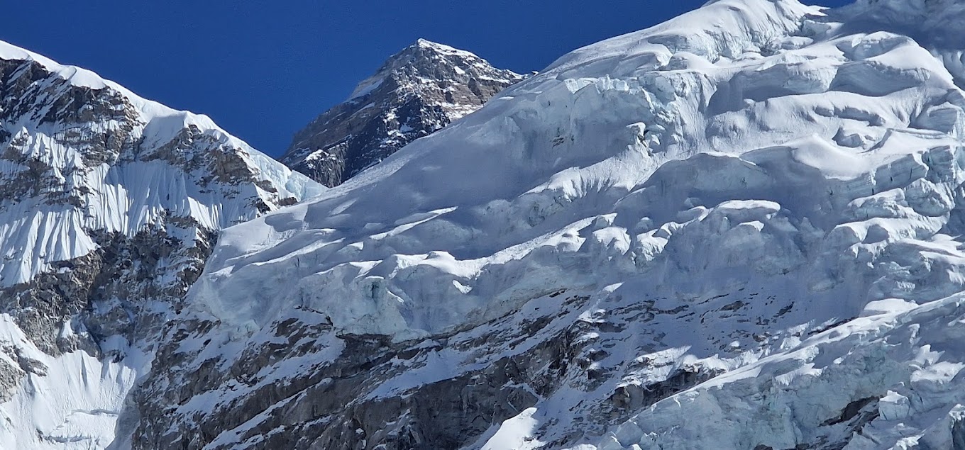
Kyajo Ri (6,186m) — one of the Khumbu's quietest summits, a technical step up hidden in an isolated valley off the main trails.
Expedition Overview
What is the Kyajo Ri Expedition?
Kyajo Ri stands at 6,186 metres in the Khumbu region of Nepal, rising on the little-visited border between the Thame and Gokyo valleys, north of Namche Bazaar. Opened for climbing by the Nepalese Ministry of Tourism in 2002 and first summited that same year by a British and French team via the Southwest Ridge, Kyajo Ri remains one of the quietest 6,000m objectives in the entire Khumbu, graded PD+ to AD-, technical without being extreme.
AltiPro's Kyajo Ri Expedition follows the classic Khumbu approach through Namche Bazaar before leaving the main trekking trails entirely, crossing into the isolated Kyajo Drangka valley to a dedicated Base Camp at approximately 4,550m. Above Base Camp, the route establishes two high camps, Camp 1 at around 5,350m and Camp 2 at approximately 5,700m, before a summit push involving steep snow slopes of 50 to 55 degrees, mixed rock scrambling, and glacier travel to the top at 6,186m. The expedition spans 20 days from Kathmandu to return.
Kyajo Ri is rated Challenging. AltiPro recommends prior experience on a standard NMA trekking peak, such as Island Peak or Lobuche East, along with solid crampon and ice axe technique, before attempting Kyajo Ri. It is not intended as a first Himalayan summit, but is considerably less serious than fully technical peaks such as Cholatse or Taboche, making it a well-suited next step for climbers building toward bigger objectives.
About Kyajo Ri — One of the Khumbu's Quietest Summits
Kyajo Ri sits in the isolated Kyajo Drangka valley, a broad, secluded basin south of the peak reached by leaving the main Khumbu trekking trails and following a faint yak trail over a series of passes near Mende. This genuine remoteness, combined with a route free of fixed rope and anchors, gives Kyajo Ri a wild, pristine character rarely found on Nepal's more established trekking peaks, most of which the approach shares no trail with, including the Gokyo Lakes and Cho La Pass trek that passes through the neighbouring valley.
Kyajo Ri is administered by the Nepal Mountaineering Association and requires a Khumbu Pasang Lhamu Rural Municipality Entrance Permit alongside the standard climbing and national park permits, a Khumbu-specific requirement that replaced the TIMS card for this region. The mountain sees only a small number of ascents each season, a fraction of the traffic on Island Peak or Lobuche East, making it one of the genuinely least-crowded climbing objectives in the Khumbu.
From the summit, climbers are rewarded with sweeping views across four of the world's highest peaks: Everest, Lhotse, Makalu, and Cho Oyu, with the Gokyo and Thame valleys spread out on either side below.
Why Choose AltiPro Adventures for Kyajo Ri?
A Genuine Next Step After a Trekking Peak
Kyajo Ri's mixed snow, ice, and rock terrain makes it a well-suited progression for climbers who have already completed a peak such as Island Peak or Lobuche East and want a more serious technical objective. AltiPro's Sherpa guides run detailed technique training at Base Camp before the two-camp summit push.
One of the Khumbu's Quietest Climbs
The isolated Kyajo Drangka valley approach sees a fraction of the traffic found on the Khumbu's standard trekking peaks, offering a genuinely wild, uncrowded high-altitude experience.
Combine with Gokyo or the Thame Valley
AltiPro can extend the itinerary with a side trip through the Gokyo Lakes and Cho La Pass region, or via the historic Thame valley, before branching off toward Kyajo Ri Base Camp.
Full Technical Equipment and Support
All technical climbing equipment is provided by AltiPro: crampons, harness, ice axe, helmet, and rope, along with cook staff at Base Camp and both high camps. Climbers do not need to own or bring technical climbing gear.
Medical Support
A full medical kit at Base Camp and higher camps, with satellite communication for emergency coordination. The well-established Khumbu helicopter evacuation network provides rapid access to Lukla or Kathmandu if required.
Spring and Autumn Options
AltiPro operates Kyajo Ri in both spring (March–May) and autumn (September–November), the two stable weather windows for the summit slopes.
The Southwest Ridge Route (6,186 m)
The standard route on Kyajo Ri leaves the main Khumbu trails entirely, crossing into the isolated Kyajo Drangka valley before establishing two high camps for the technical summit push.
Kathmandu to Namche Bazaar via Lukla (1,400m to 3,440m)
Flight from Kathmandu to Lukla, then trek through Phakding to Namche Bazaar, the Sherpa capital of the Khumbu, with a rest day for acclimatisation.
Namche to Mende (3,440m to 3,800m)
Leave the main Everest Base Camp and Gokyo trails, following a quieter path toward Mende, the last point before the route enters genuinely remote terrain.
Mende to Kyajo Ri Base Camp (3,800m to 4,550m)
Follow a faint yak trail over a series of passes into the isolated Kyajo Drangka valley, reaching AltiPro's established camp beside a freshwater stream, with an acclimatization day built in.
Base Camp to Camp 1 (4,550m to 5,350m)
Ascend mixed scree, rock, and boulder terrain up the valley toward the Southeast Col, gaining Camp 1 with fine views over the surrounding peaks.
Camp 1 to Camp 2 (5,350m to 5,700m)
Continue over increasingly technical mixed ground to Camp 2, positioned below the final summit slopes, with a rest day built in before the summit push.
Camp 2 to Summit (5,700m to 6,186m)
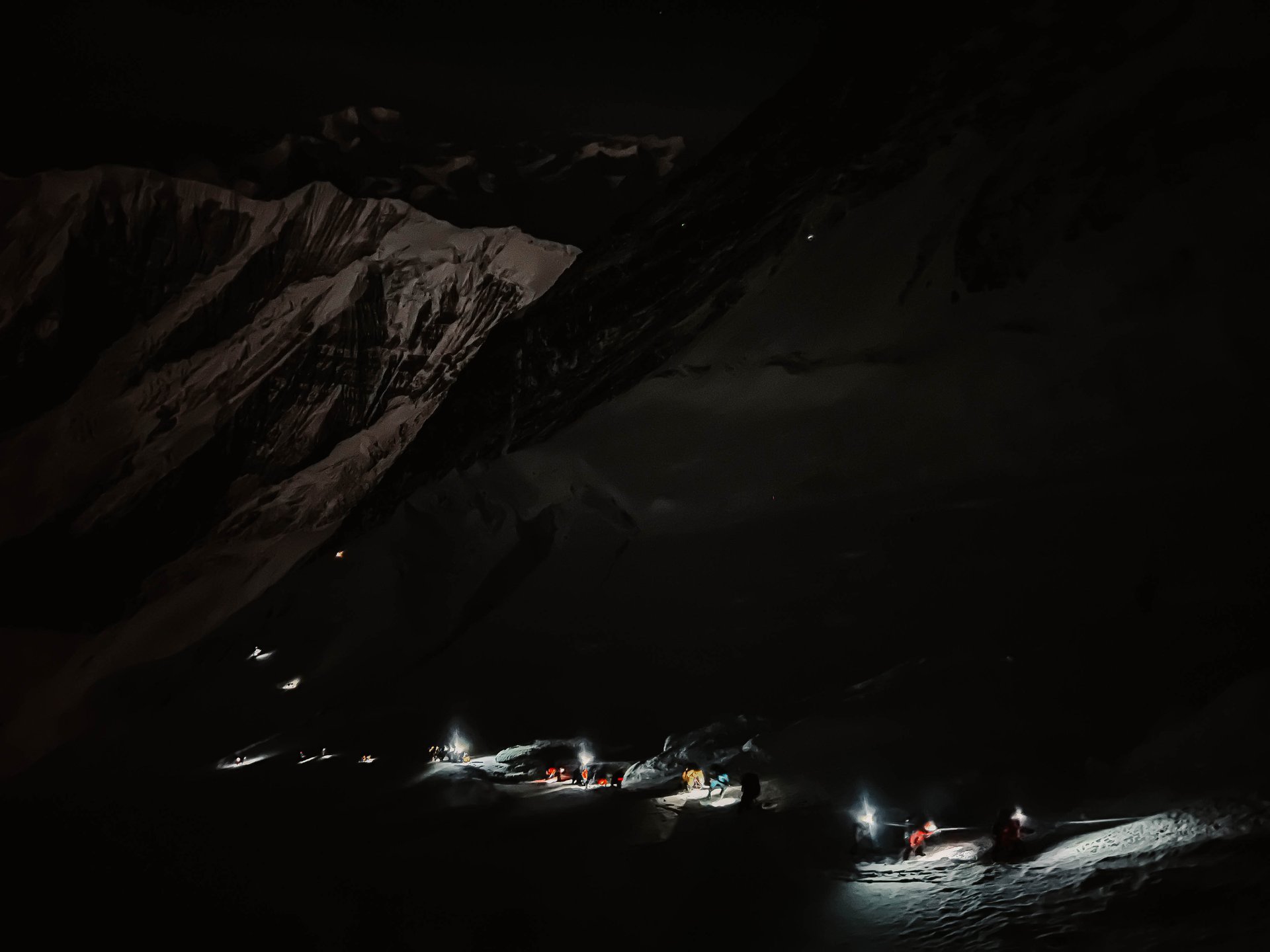
Summit day begins with a scramble by head-torch to the Southeast Col before daylight, followed by steep snow slopes of 50 to 55 degrees and short sections of glacier and mixed terrain to the summit at 6,186m, with sweeping views across Everest, Lhotse, Makalu, and Cho Oyu.
How Difficult is the Kyajo Ri Expedition?
Kyajo Ri is graded PD+ to AD- on the alpine scale, technical without being extreme. The climb involves mixed snow, ice, and rock terrain, steep slopes of 50 to 55 degrees, and a route deliberately kept free of fixed rope and anchors to preserve its wild condition. This makes Kyajo Ri more demanding than standard trekking peaks such as Mera Peak or Island Peak, while remaining considerably less serious than fully technical objectives such as Cholatse or Taboche.
Best Season for the Kyajo Ri Expedition
Spring (March–May): Stable pre-monsoon conditions on the summit slopes, with clear views across the Khumbu's highest peaks.
Autumn (September–November): Crisp post-monsoon conditions with firm snow on the summit headwall. October and November are considered the ideal months for the Kyajo Ri summit. AltiPro operates both seasons, contact for current dates.
Kyajo Ri Expedition Cost
Full-service Kyajo Ri expedition — Khumbu approach, all technical summit equipment, and full Sherpa support included.
Includes NMA climbing permit, Sagarmatha National Park entry, Khumbu Pasang Lhamu Rural Municipality Entrance Permit, full Sherpa support to summit, all technical equipment for summit day (crampons, harness, rope, ice axe, helmet), Base Camp and high camp cook service, and a complete medical kit. International flights, Lukla domestic flights, and personal trekking equipment are not included. Contact AltiPro for a complete Kyajo Ri climbing cost breakdown.
Kyajo Ri Expedition — Frequently Asked Questions
Common questions about climbing Kyajo Ri with AltiPro Adventures.
How difficult is Kyajo Ri?
Kyajo Ri is graded PD+ to AD- on the alpine scale, technical without being extreme. The climb involves mixed snow, ice, and rock terrain and steep slopes of 50 to 55 degrees, making it more demanding than a standard trekking peak but less serious than fully technical objectives like Cholatse or Taboche.
Is Kyajo Ri suitable for a first climb?
No. AltiPro recommends prior experience on a standard NMA trekking peak, such as Island Peak or Lobuche East, before attempting Kyajo Ri. It is best suited as a next step for climbers building technical experience.
What is the Kyajo Ri climbing cost?
AltiPro's full-service package includes permits, the Khumbu approach, Sherpa support, all technical summit equipment, and Base Camp and high camp services. Contact AltiPro for a current, detailed cost breakdown.
Can Kyajo Ri be combined with Gokyo or the Thame Valley?
Yes. AltiPro can extend the itinerary with a side trip through the Gokyo Lakes and Cho La Pass region or the historic Thame valley before branching off into the isolated Kyajo Drangka valley toward Base Camp.
What technical skills are needed to climb Kyajo Ri?
Solid crampon and ice axe technique, comfort on steep 50 to 55 degree snow slopes, roped glacier travel, and basic mixed rock scrambling ability are all essential. AltiPro's Sherpa guides run technical training at Base Camp before the two-camp summit push.
How long is the Kyajo Ri expedition?
20 days from Kathmandu to return, including the Lukla flight, the approach through Namche Bazaar and the isolated Kyajo Drangka valley, and the summit attempt on Kyajo Ri (6,186m).
What are the summit views like from Kyajo Ri?
The summit delivers sweeping views across four of the world's highest peaks: Everest, Lhotse, Makalu, and Cho Oyu, with the Gokyo and Thame valleys spread out on either side below.
What permits are required to climb Kyajo Ri?
A Nepal Mountaineering Association (NMA) climbing permit, Sagarmatha National Park entry, and the Khumbu Pasang Lhamu Rural Municipality Entrance Permit, which replaces the TIMS card for this region. AltiPro manages all permit applications from Kathmandu.
Detailed Itinerary
Click on each day to view details
| Day | Program | Meals | Accom. | |||||||||||||||||||||||||||||||||||||||||||||||||||||||||||||||||||||||||||||||||||||||||||||||||||||||||||||||||||||||||||||||||||||||||||||||||||||||||||||||||||||||||||||||||||||||||||||||
|---|---|---|---|---|---|---|---|---|---|---|---|---|---|---|---|---|---|---|---|---|---|---|---|---|---|---|---|---|---|---|---|---|---|---|---|---|---|---|---|---|---|---|---|---|---|---|---|---|---|---|---|---|---|---|---|---|---|---|---|---|---|---|---|---|---|---|---|---|---|---|---|---|---|---|---|---|---|---|---|---|---|---|---|---|---|---|---|---|---|---|---|---|---|---|---|---|---|---|---|---|---|---|---|---|---|---|---|---|---|---|---|---|---|---|---|---|---|---|---|---|---|---|---|---|---|---|---|---|---|---|---|---|---|---|---|---|---|---|---|---|---|---|---|---|---|---|---|---|---|---|---|---|---|---|---|---|---|---|---|---|---|---|---|---|---|---|---|---|---|---|---|---|---|---|---|---|---|---|---|---|---|---|---|---|---|---|---|---|---|---|---|---|---|---|
| 1 | Arrival in Kathmandu | Dinner | Hotel | |||||||||||||||||||||||||||||||||||||||||||||||||||||||||||||||||||||||||||||||||||||||||||||||||||||||||||||||||||||||||||||||||||||||||||||||||||||||||||||||||||||||||||||||||||||||||||||||
|
Arrive at Kathmandu Tribhuvan International Airport. Transfer to hotel, welcome dinner, and Kyajo Ri Expedition briefing.
2
|
Kathmandu – Permit Processing & Expedition Briefing |
Breakfast / Dinner |
Hotel |
|
|
Process NMA climbing permit, Sagarmatha National Park entry, and Khumbu Pasang Lhamu Rural Municipality Entrance Permit, gear check, and technical route briefing.
3
|
Fly Kathmandu → Lukla (2,840m) – Trek to Phakding (2,610m) |
Breakfast / Lunch / Dinner |
Lodge |
|
|
35-minute mountain flight to Lukla. Meet the climbing team and trek down the Dudh Koshi valley to Phakding.
4
|
Trek Phakding → Namche Bazaar (2,610m to 3,440m) |
Breakfast / Lunch / Dinner |
Lodge |
|
|
Cross the Dudh Koshi on suspension bridges and climb steadily into Sagarmatha National Park to the Sherpa capital, Namche Bazaar.
5
|
Acclimatization Day at Namche Bazaar (3,440m) |
Breakfast / Lunch / Dinner |
Lodge |
|
|
Rest day with an acclimatization hike to Everest View Hotel (3,880m) for first views of Everest, Lhotse, and Ama Dablam.
6
|
Trek Namche → Mende (3,440m to 3,800m) |
Breakfast / Lunch / Dinner |
Lodge/Tent |
|
|
Leave the main Everest Base Camp and Gokyo trails, following a quieter path toward Mende, the last point before the route enters remote terrain.
7
|
Trek Mende → Kyajo Ri Base Camp (3,800m to 4,550m) |
Breakfast / Lunch / Dinner |
Tent |
|
|
Follow a faint yak trail over a series of passes into the isolated Kyajo Drangka valley, reaching AltiPro's established camp beside a freshwater stream.
8
|
Acclimatization Day at Base Camp (4,550m) |
Breakfast / Lunch / Dinner |
Tent |
|
|
Rest and altitude adaptation at Base Camp, with a short walk around the valley to aid acclimatization after the longer approach day.
9
|
Climbing Training at Base Camp (4,550m) |
Breakfast / Lunch / Dinner |
Tent |
|
|
Climbing Sherpa route briefing, crampon and ice axe technique review, and roped travel training ahead of the ascent to Camp 1.
10
|
Climb Base Camp → Camp 1 (4,550m to 5,350m) |
Breakfast / Lunch / Dinner |
Tent |
|
|
Ascend mixed scree, rock, and boulder terrain up the valley toward the Southeast Col, gaining Camp 1 with fine views over the surrounding peaks.
11
|
Climb Camp 1 → Camp 2 (5,350m to 5,700m) |
Breakfast / Lunch / Dinner |
Tent |
|
|
Continue over increasingly technical mixed ground to Camp 2, positioned below the final summit slopes.
12
|
Rest Day at Camp 2 (5,700m) |
Breakfast / Lunch / Dinner |
Tent |
|
|
Rest and final preparation at Camp 2 before the summit push, with equipment checks and a weather window review.
13
|
Summit Day – Kyajo Ri (6,186m) |
Breakfast / Lunch / Dinner |
Tent |
|
|
Pre-dawn scramble by head-torch to the Southeast Col, followed by steep snow slopes of 50 to 55 degrees and mixed terrain to the summit at 6,186m, then descend fully to Base Camp.
14
|
Rest & Recovery at Base Camp (4,550m) |
Breakfast / Lunch / Dinner |
Tent |
|
|
Rest and recovery at Base Camp. Post-summit celebration.
15
|
Trek Base Camp → Mende (4,550m to 3,800m) |
Breakfast / Lunch / Dinner |
Lodge/Tent |
|
|
Retrace the yak trail out of the Kyajo Drangka valley back to Mende.
16
|
Trek Mende → Namche Bazaar (3,800m to 3,440m) |
Breakfast / Lunch / Dinner |
Lodge |
|
|
Rejoin the main Khumbu trail and descend to Namche Bazaar.
17
|
Trek Namche Bazaar → Lukla (2,840m) |
Breakfast / Lunch / Dinner |
Lodge |
|
|
Final descent day, following the Dudh Koshi valley back to Lukla.
18
|
Fly Lukla → Kathmandu |
Breakfast / Dinner |
Hotel |
|
|
Fly from Lukla to Kathmandu. Farewell dinner and Kyajo Ri climbing certificate presented.
19
|
Buffer Day – Weather or Logistics Reserve |
Breakfast |
Hotel |
|
|
Reserved buffer for weather delays, a second summit window, or Lukla flight disruptions.
20
|
Final Departure from Kathmandu |
Breakfast |
|
|
|
Transfer to Kathmandu Tribhuvan International Airport for international departure.
| ||||||||||||||||||||||||||||||||||||||||||||||||||||||||||||||||||||||||||||||||
Services
Includes
Excludes
Gear Lists & Useful Information
No Gear Lists Available
Gear lists and additional information for this expedition will be available soon.
Been on this expedition?
Your feedback helps other travelers plan their adventure of a lifetime. Share your experience with us!
Cholatse Expedition
Cholatse Peak (6,440m) — a striking technical summit in Nepal’s Khumbu region, rising above the Dudh Koshi Valley and surrounded by the dramatic peaks of Everest, Ama Dablam, Taboche, and Lobuche.
Chulu East Expedition
Chulu East (6,584m) — a remote Annapurna summit above the Manang Valley, ringed by Annapurna II, III, IV, and Gangapurna.
Chulu West Expedition
Chulu West (6,419m) — an ice wall and glacier ridge above the Annapurna Circuit, paired with a classic Thorong La crossing.
Dhampus peak expedition
Dhampus Peak (6,012m) — also known as Thapa Peak, a two-pass Himalayan crossing linking Mustang to the Annapurna Circuit.
Hiunchuli Peak Expedition
Hiunchuli (6,441m) — guardian of the Annapurna Sanctuary, one of Nepal's most serious trekking peaks.
Island Peak Expedition
Island Peak (6,189m) — Imja Tse, the Khumbu's classic training summit, ringed by Lhotse, Nuptse, and Ama Dablam.
Larkya Peak Expedition
Larkya Peak (6,249m) — Manaslu's quiet neighbour above the Larkya La, a natural warm-up for the big mountain itself.
 6000m
6000m
Lobuche East Expedition
Lobuche East (6,119m) — the Khumbu's most technical trekking peak, rising above the Everest Base Camp trail.
Lobuche West Expedition
Lobuche West (6,145m) — the higher, far less climbed of Lobuche's two summits, a serious expedition-grade South Ridge.
Taboche Peak Expedition
Taboche (6,495m) — a serious rock and ice ridge climb above Pheriche, directly across the valley from Ama Dablam.
Ready to Start Your Adventure?
Contact us to book your expedition or get more information